Oman uses surveying drone for mines mapping and build 3D model
Oman's artificial intelligence pilot area Opaz and Marmul Integrated Company recently successfully conducted several experiments and aerial surveys using drone at a mine in Sezad, with positive results, helping to make decisions aimed at improving productivity and appropriate Appropriate decision-making for planning quarries and mining sites, as well as improving knowledge in safety and security and inventory management.
Ahmed Al Farsi, chairman of the steering committee overseeing the AI zone, said that mining survey experiments using drones to collect aerial data on mining sites are processed through specialized procedures and form the basis of these sites. 3D map. She added that the experiments proved that surveying drones mounted lidars, in addition to mine mapping, can also be used to monitor civil engineering and produce full or partial panoramic images and 3D models of the target land.
At present, drone surveying and mapping mainly use two types of drone
1. Buildings, bridges or small area surveying and mapping modeling generally use multi-rotor UAVs
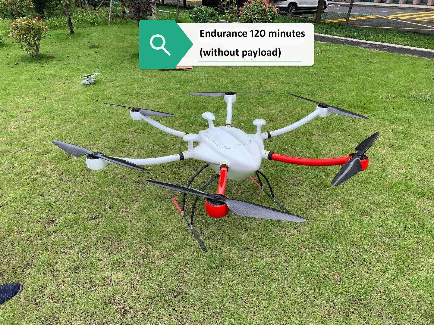
FlyDragon FD1660 made of glass fiber so that the GPS signal won’t be blocked. The closed fuselage structure can protect FD1660 from the rain and dust IP56
FD1660 can payload Lidar and sensor for aerial photography, emergency rescue, reconnaissance mission, power line inspection, remote sensing survey and mapping etc.

2. Large-scale area surveying and mapping such as airport surveying and mapping, national land surveying and mapping, forest surveys, and aerial inspections of forest fires use vertical take-off and landing fixed-wing UAVs.
a. If it is only orthophoto mapping, it is recommended to use pure electric vertical take-off and landing fixed-wing UAV
FDG30 Mako shark electric long endurance VTOL fixed wing mapping drone was developed by FlyDragon Aviation UAV company, droen frame is carbon fiber mamertial, FDG30 endurance is 6 hours with 1kg payload, it's the one of best VTOL for mapping&surveillance on the mraket

b. If you need UAV mounted lidar surveying and mapping 3D modeling, it is recommended to use FDG35VTOL drone, FDG35 is a electric heavy payload and long endurance mapping VTOL drone, FDG35 endurance time is: 140min/5kg, 70min/10kg,


