Photogrammetry and LiDAR Lidar Technology Which is better for drone Mapping
drone photogrammetry and lidar mapping. It is the two most commonly used surveying and mapping methods at present. The choice of photogrammetry or lidar surveying and mapping depends on the actual engineering requirements and construction costs.

1. How does UAV photogrammetry work?
Photogrammetry is a technique for reconstructing the spatial position and three-dimensional shape of an object by using the image of the subject.
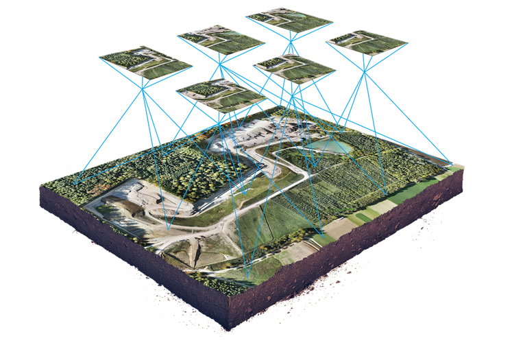
In photogrammetry, drones capture a large number of high-resolution photos of an area, so the same point on the ground can be seen in multiple photos and from different vantage points. Then use similar PIX4D software to connect these high-definition pictures together to generate a 3D map.
Therefore, a high-resolution 3D reconstruction contains not only elevation/height information, but also the texture, shape, and color of each point on the map.

2. How does UAV lidar mapping work?
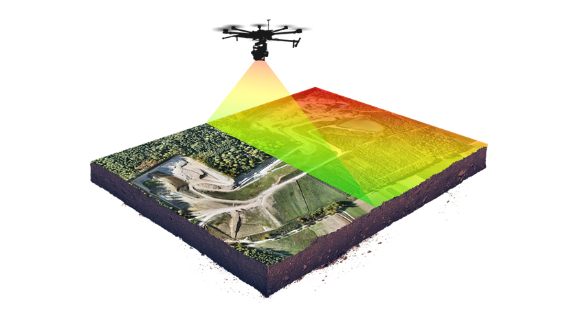
The lidar sensor sends out laser pulses and measures the exact time when those pulses return as they bounce off the ground. It also measures the strength of the reflection. Lidar also requires a high-precision satellite positioning system (GNSS) and high-precision sensors known as inertial measurement units (IMUs) to determine the sensor's orientation in space.

3. the accuracy comparison
Both photogrammetry and lidar provide significant levels of 3D model accuracy, especially when compared to ground-based sampling methods.
 A. UAV photogrammetry: A full-frame sensor camera such as the A7R II can produce output with horizontal (xy) accuracy within 1 cm (0.4 inches) and elevation (z) accuracy within 2.
B. UAV Lidar Mapping: High-end systems can produce results with horizontal (xy) and elevation (z) accuracy in the 1 to 2 cm range. For this extra 1 cm (0.4 in) of vertical accuracy, there will be a higher cost in system cost and operational complexity compared to photogrammetry.
High-end photogrammetry systems cost between $20,000 and $30,000; lidar systems typically cost upwards of $50,000 for sensors alone.
Applications of UAV Photogrammetry and Lidar Mapping
For most tasks, 3D results obtained from photogrammetry are similar to those obtained from lidar, and drone photography has high-resolution visual data and therefore is more versatile. But there are certain applications where lidar is more appropriate, and some of these examples are discussed below.
Terrain modeling under vegetation
In some specific cases, the terrain model below the vegetation is required as output. Although photogrammetry can be used to effectively create 3D models in areas with sparse vegetation, when dealing with areas with relatively dense vegetation, lidar is obviously better than photogrammetry. More suitable.
Note, however, that lidar pulses do not pass through very dense vegetation canopies.

extensive detailed investigation
Powerful drones paired with high-resolution cameras can map hundreds of hectares in a single flight, producing stunning 2D and 3D results. The work efficiency is more than 5 times that of lidar.
Some professional drones can capture up to 400 hectares (988 acres) in a single flight at a resolution of 2.5 cm/pixel (1 inch/pixel).

operational considerations
The differences between photogrammetry and lidar increase when operational and logistical factors are considered. To produce high-quality results, a lidar system requires all its components to work in perfect synchronization, and small gaps or errors in sensor measurements can cause significant errors in the output. Or worse, the output "looks" correct, but isn't, techniques like ground control points (GCPs) are very useful in correcting problems in photogrammetry, and more difficult to achieve with lidar. In most cases, the only solution to erroneous lidar data is to repeat the flight.
Lidar projects require an expert who understands the workflow and details of each subsystem and can identify consistent and accurate data.
In contrast, photogrammetry-based workflows are more forgiving. Redundancies created by multiple overlapping images of the same point on the ground can be error-corrected during processing and translated into high-precision output even under non-ideal conditions or operations. Drone-based photogrammetry has a shorter learning curve (even for inexperienced operators), which leads to greater flexibility and cost-effectiveness.


