Surveying and mapping drones in the field of aerial remote sensing
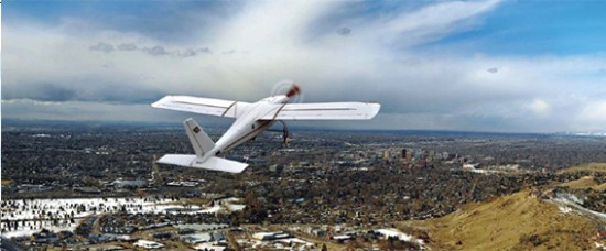
Satellite remote sensing images as a supplement to vector maps have been welcomed by the public. However, as a professional geographic information application, there are weaknesses such as insufficient data acquisition capabilities, poor current situation, and slow return visits. Surveying and mapping drone emerged as a low-cost, high-precision, and easy-to-operate remote sensing image acquisition equipment, and have achieved good results in traditional surveying and mapping, digital city construction, geographic national conditions monitoring, and disaster emergency response.

Advantages of UAV for Surveying and Mapping
UAVs are equipped with sensors to capture aerial remote sensing images. On the one hand, low-altitude remote sensing is widely recognized and needs to be vigorous. On the other hand, compared with other remote sensing data acquisition methods, surveying and mapping UAVs have irreplaceable advantages:

Cost-effective
The price of domestic surveying and mapping UAVs on the market is about hundreds of thousands to hundreds of thousands, and they can be reused many times. They are not easily damaged except for major accidents, and there are no additional usage costs. Images with a resolution of up to 0.05 meters are more accurate than satellite images.

Convenient to carry and transport
The wingspan of a fixed-wing surveying UAV generally does not exceed 3 meters and can be easily disassembled. During the execution of the project, only the disassembled UAV equipment needs to be placed in an ordinary small truck, and the operator and all equipment can be transported to the destination at the same time. After arriving at the scene, the UAV can be assembled and debugged within 15 minutes.
No venue requirements
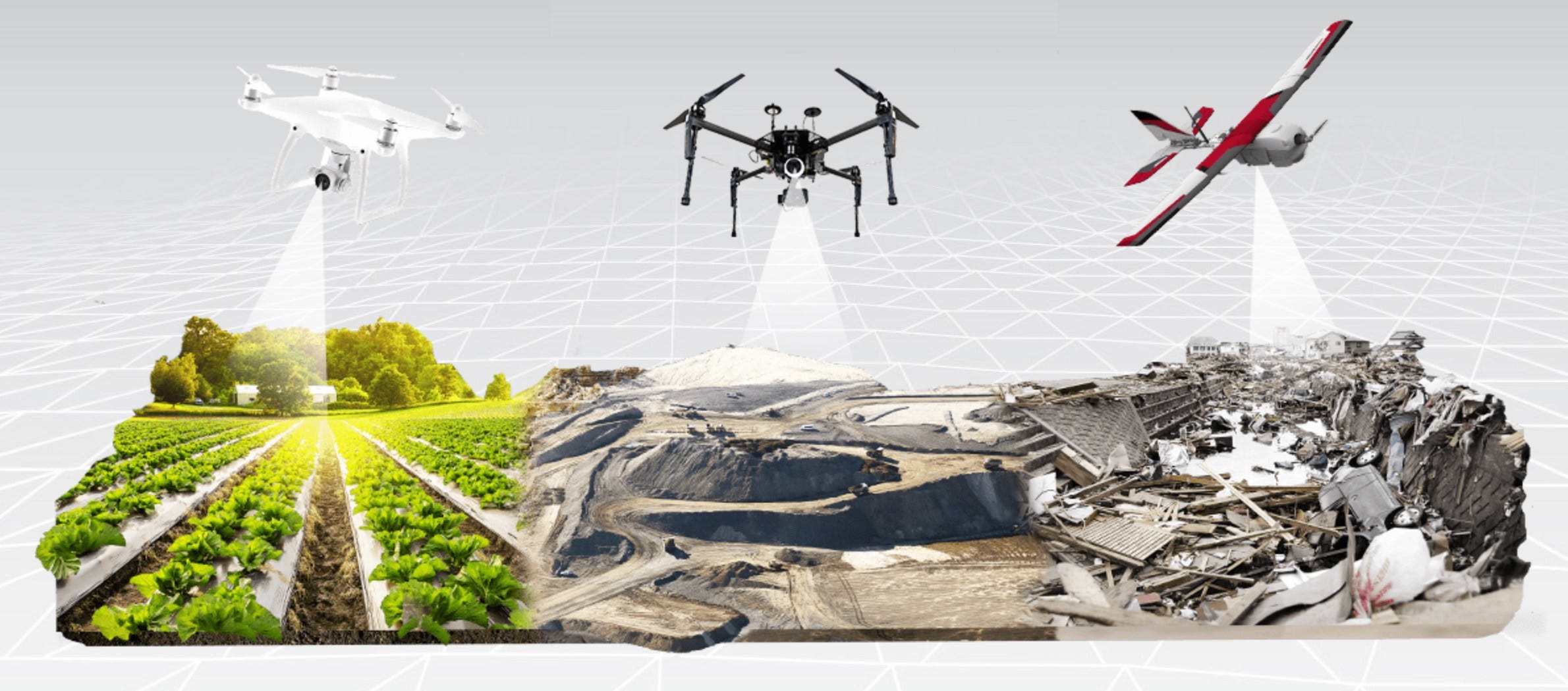
The traditional take-off method of UAV for surveying and mapping is generally skid-up, requiring a relatively horizontal runway of 30 meters to 50 meters to take off. With the introduction of new equipment, the venue is no longer an obstacle to the take-off and landing of drones. At present, common UAVs can take off by ejection, hand throwing, vertical take-off and landing, in addition to sliding up.
Flexible
Surveying and mapping drones can determine the flying height according to the required image resolution. In most cases, the flying height is generally 100 meters to 1000 meters. Most of the cameras carried by surveying drones use fixed-focus lenses, and the difference in flying height directly affects the resolution of the final generated image. You can obtain ideal data by designing the route and determining the flight altitude before flying.
Less affected by the weather
In traditional aerial photography, the biggest concern for large aircraft aerial photography is the unsatisfactory weather conditions. Once cloudy weather appears, it will seriously affect the imaging effect. However, the flying height of the surveying and mapping drone determines that the thickness of the cloud will basically not affect the imaging, especially when the high-resolution image is obtained and the flying height is low.
Surveying and mapping drone application
In traditional land surveying and mapping applications, compared with satellite imagery, the image obtained by drones does not seem to have more advantages except for higher resolution. But in more applications, what drones can do is far beyond what you can imagine.
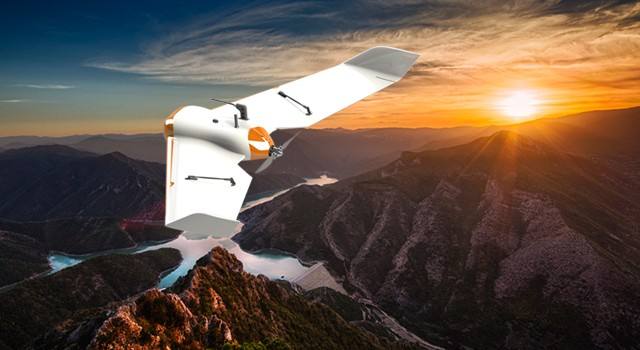
Land surveying and mapping. Compared with traditional surveying and mapping methods, UAV surveying and mapping can play an important role in the field of land surveying and mapping by virtue of its mobility and flexibility. By quickly acquiring aerial photography data of surveying and mapping drones, it is possible to quickly grasp the detailed situation of the survey area, which can be applied to dynamic monitoring and investigation of land resources, land use and cover map update, land use dynamic change monitoring, characteristic information analysis, etc. High-resolution aerial images can also be used in regional planning and so on.
Line selection design
Remote sensing UAVs can be applied to power line selection, highway line selection, and railway line selection. It can quickly obtain linear UAV aerial images according to project requirements and quickly provide design data for line selection. In addition, remote sensing drones can also design and perform all-round monitoring of oil and natural gas pipelines. Centimeter-level aerial images and high-definition video can assist in safety monitoring and management. At the same time, pipeline pressure data combined with images can be used to detect pipeline leakage. , Theft and other phenomena.
Environmental monitoring
Efficient and rapid acquisition of high-resolution aerial images can timely monitor environmental pollution, especially pollution. In addition, marine monitoring, oil spill monitoring, water quality monitoring, wetland monitoring, solid pollutant monitoring, coastal zone monitoring, vegetation ecology, etc. can all be implemented with the help of aerial images or video data taken by remote sensing drones. Among them, water quality investigation and monitoring, pollutant monitoring, atmospheric environment monitoring, solid waste detection, and straw burning ban monitoring are the main application directions.
Water conservancy monitoring
On land, remote sensing drones can be used for flood monitoring, river management, river pollution detection, etc. UAVs can determine routes according to terrain and river conditions, and conduct emergency monitoring of traffic conditions, monitoring of flood disasters in beach areas, water pollution and other emergencies. In addition, remote sensing drones can also be applied to coastal surveys, such as land reclamation, aquaculture, coastal changes, etc., near island and reef monitoring, target identification of ships, algae, buoys, and marine environment monitoring.
Agriculture and Forestry
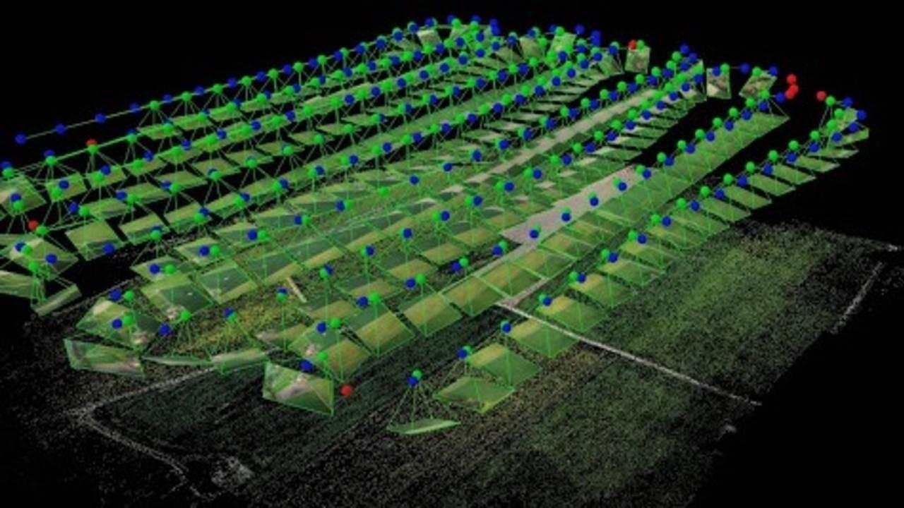
High-resolution aerial images can provide accurate land texture and crop classification information, which can be applied to agricultural land analysis, crop type identification, crop growth analysis, soil moisture measurement, agricultural environmental investigation, aquaculture area monitoring, forest fire monitoring, forest cover Rate analysis, forest vegetation health monitoring, forest reserve assessment, etc. It can determine planting area, growth status, growth stage and output value estimation for specific agricultural crops. For example, it has important applications in tobacco, agricultural Internet of Things and other industries.
Change analysis
By customizing the revisit period, remote sensing drones can effectively monitor the dynamic changes in local areas. For example, in applications such as flood analysis, demolition compensation, etc., many conflicts are often caused because the two sides hold different opinions. After the remote sensing drone is used for aerial photography, the relevant change area can be very clear on the final image. In the fields of urban construction and planning, coastal flooding analysis, and other fields, remote sensing drones can play an important role.
Emergency response
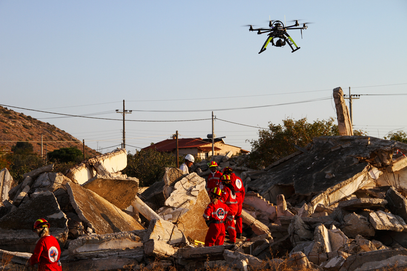
Unmanned aerial vehicles have received attention in the field of surveying and mapping, starting from the emergency response to disasters. Whether it was the Wenchuan Earthquake, Yushu Earthquake, Yingjiang Earthquake, Zhouqu mudslides, Ankang floods, surveying and mapping drones arrived at the scene at the first time, and gave full play to their mobility and flexibility to obtain image data of the disaster area and deploy them for disaster relief. And the development of post-disaster reconstruction work has played an important role.
FlyDragon FLY-420 eVTOL for mapping &surveying
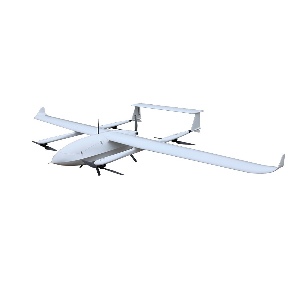
FLY-420 eVTOL UAV can carry Lidar with 7 KGS fly 1.5 hours for survey
FlyDragon FLY-420 VTOL (electric vertical takeoff and landing) is a type of aircraft that uses electric power to hover, take off, and land vertically. This technology came about thanks to major advances in electric propulsion (motors, batteries, electronic controllers) and the growing need for new vehicles. FLY-420 industry leading mid-to-long range UAV, optimized for tight launch and landing zones. This extremely versatile platform can be retrofitted for many applications, including but not limited to: Agriculture, surveying, search and rescue, pipeline monitoring, emergency response, infrastructure inspection, and disaster relief. From small businesses seeking value to government and enterprise level organizations that require efficiency and ease of use, Flydragon FLY-420 is the best in class UAV solution.
Specification:
Wingspan: 4210MM Captain: 2100mm
Aircraft material: full composite material
Maximum take-off weight: 32 kg
Standard take-off weight: 30 kg
Life time: 4 hours (load 1 kg)
2 hours (load 5 kg)
1.5 hours (load 7 kg)
Wind resistance: level 6
Waterproof: IP34
Service ceiling: 6000 meters
Load: 1-7 kg
Flying speed: 23-25 m/s
Equipment cabin space: 400MM*340MM*270MM
Salient features:
1. The whole machine adopts full composite materials, excellent flight start layout, reserved electric and gasoline engine interfaces, which is convenient to use different power schemes.
2. Large-sized task bin, suitable for carrying a variety of large-scale tasks including lidar, full-frame tilt camera, etc., and a task load of up to 7 kg, realizing multi-purpose.
3. Unique structure design, overall quick release structure design, convenient for transportation and installation. Good pitch, roll and direction attitude, super high flight path accuracy.


