

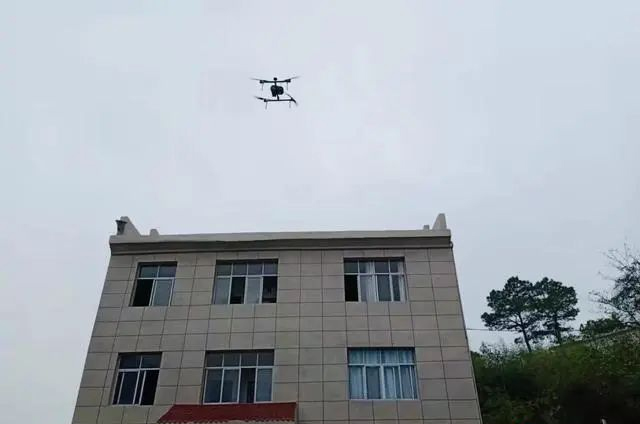
In order to do a good job in the prevention and control of pine wood nematode disease, effectively prevent the pine wood nematode disease epidemic, and ensure the ecological safety of pine resources and the safety of people's lives and property, De'an County uses drones to carry out forest pine wood nematode epidemic monitoring.

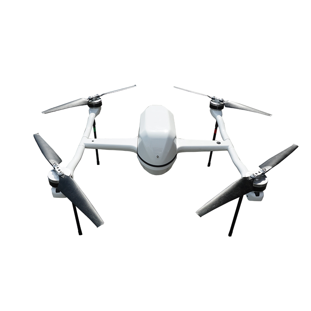
mapping drone FDM07 Multi-rotor UAV is a 7KG multi-rotor flight carrier platform,It is portable, easy to use, easy to operate, efficient and stable, wind-resistant and durable. Certainly Located in large-load, long-endurance, and high-cost aircraft, it improves the efficiency of aerial survey operations and reduces , Low flight risks and operating costs, and strive to achieve good flight and good use!
mapping drone Open flight control equipment compartment, compatible with most conventional flight control equipment on the market, mission. The device is mounted on cameras that support multiple specifications and types, and the flight uses 6S 30000 lithium polymer Battery to meet long battery life and high-quality shooting effects. mapping drone Can be applied to topographic surveying and mapping, real scene Three-dimensional, agriculture, forest monitoring and animal husbandry protection, power line inspection, environmental protection, water conservancy and other aspects.
Product parameter specifications
Material: carbon fiber, PC, engineering plastics, etc.
Wheelbase: 700mm Captain: 500mm
Maximum flying weight: 7KG
Economic flight speed: 9M/S~12M/S
Payload: <2.5KG
Endurance: 65-70 minutes(with 500gram payload)
Wind resistance:
Take-off and landing method: vertical take-off and landing
Disassembly and assembly method: disassembly and assembly without tools


Contact: Fly Dragon Drone Tech.
Email: frank at dronefromchina.com
Add: NO. 9 Dayu Road PiDu distric, ChengDu 611730, China