News

Drone mapping guid for 2022

Drone surveying and mapping is one of the most widely used uses of drone technology, and traditional methods of drone surveying and mapping collect data more than 90% faster. Drone mapping has the potential to reduce weeks to one week, helping teams collect data quickly, accurately, and safely. this articl is the Drone mapping guid, will let you what is drone mapping?

What is drone mapping?

Drone mapping is an aerial surveying system performed by drones and professional cameras, which can include orthophoto, LiDAR 3D point cloud mapping.

Drone mapping is a safer way to collect data: it can avoid having employees work in dangerous terrain

This data collected by drone mapping can be processed by drone mapping software to create a range of outcomes, such as 3D models, 2D maps, and digital elevation models, that help make informed decisions and provide valuable Insights and keep abreast of project progress.

The two most common drone mapping methods are photogrammetry and lidar.

1. 2D Orthomosaic Drone Map

2D orthomosaics are hundreds or thousands of digital photos collected by drones. These images are processed and stitched using sophisticated software to create photorealistic, georeferenced and measurable 3D models and 2D maps of the real world. These maps and images provide a real-world view for quick decision-making and analysis of project progress.


2. 3D point cloud

The basic working principle of lidar is to emit a beam of laser light, which is refracted and received by a CMOS sensor after encountering an object to measure the distance from the body to the obstacle.

A point cloud dataset is a digital representation of a measurement area or object. It consists of thousands of points, each of which is a geometric coordinate. After merging, they built a fleshed-out 3D model. The more points collected, the denser the model.

Point clouds can provide rich information, such as observations and measurements about an object's depth, elevation, geometry, and spatial location.


Best Drone Mapping Software

Software is a fundamental part of drone mapping; processing and stitching the drone data together to create the all-important maps and models. These data sets are then used for calculations, measurements and to gather other vital insights.

DJI Terra

DJI Terra provides an end-to-end drone mapping solution and can be used in conjunction with drones such as the Phantom 4 RTK, as well as the DJI drone mapping payloads, the P1 and L1, as well as the X7.

Terra can be used to automate flight routes, create 2D and 3D maps and models and conduct detailed analysis of drone mapping data. It has extremely quick proc
essing capabilities.
DJI Terra mapping software

DroneDeploy

DroneDeploy is a comprehensive but user-friendly drone mapping software tool.

Its key features include real-time mapping, autonomous flights and a 360° virtual walkthrough mode. DroneDeploy is also compatible with an ecosystem of third-party apps.
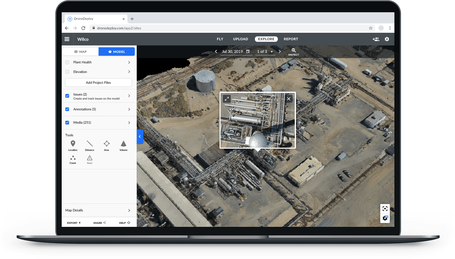
DroneDeploy drone mapping software

Pix4D

Pix4D is a professional drone mapping and photogrammetry software, It has a vast ecosystem to provide a tailored solution. For instance, its photogrammetry and geospatial software include Pix4Dmapper (for professional drone mapping); Pix4Dsurvey (bridging the gap between photogrammetry and CAD); and Pix4Dmatic (for large-scale photogrammetry).
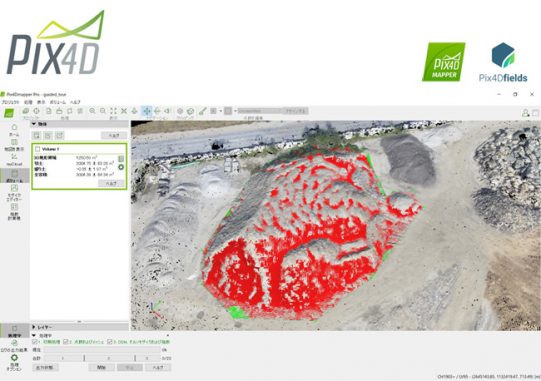
Pix4D drone mapping software

Agisoft

Agisoft is a stand-alone software product that performs photogrammetric processing of digital images and generates 3D spatial data.

Two versions are available - Standard and Professional. Standard has features such as batch processing, and can generate point clouds and highly-detailed 3D models.

Agisoft drone mapping software


Best Mapping Drones

DJI Matrice 300 RTK

The Matrice 300 RTK is DJI's most powerful commercial drone platform to date, with enhanced endurance, advanced safety systems, and an improved IP45 rating for dealing with wet weather.For mapping, it can be integrated with the P1 45MP full-frame photogrammetry camera, or the L1 LiDAR sensor - both pictured below - or the H20T camera can be deployed for thermal/visual drone mapping missions.

DJI M300 mapping drone

DJI Phantom 4 RTK

The Phantom 4 RTK is DJI's compact and low-altitude drone mapping solution, especially suited to smaller sites.It has a 20MP camera, an RTK module for real-time centimetre-level positioning data, and can be used in conjunction with the D-RTK base station.The Phantom 4 RTK is capable of achieving 1cm+1ppm RTK Horizontal Positioning Accuracy, and 1.5cm+1ppm RTK Vertical Positioning Accuracy.
DJI Phantom 4 RTK mapping drone

FDG815 small quadcopter drone

FlyDragon FDG815 small quadcopter mapping drone is a small size aerial platform  for mapping, surveillance,  inspection and food delivery.   Its compact folding airframe enables easy operation and flexible maneuvering. – Forged from a combination of carbon fiber, PCB and CNC,  the flight time boosts up to 90 minutes with no payload, and it still reaches 45minutes with 2.5kg payload.
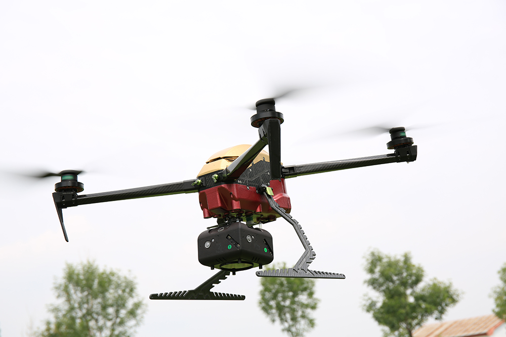
FDG815 small quadcopter mapping drone

Wingtra VTOL Fixed-wing Drone

The WingtraOne is ideal for large-area surveys and can provide absolute accuracy down to 1cm. It can be equipped with a choice of Sony high-resolution mapping cameras - including the flagship 42MP Sony RX1R II sensor, or professional multispectral cameras from MicaSense for multispectral data collection.

Wingtra VTOL Fixed-wing Drone


FDG30 Mako Shark 6 hours fixed-wing VTOL mapping drone

FDG30 electric long endurance VTOL fixed wing mapping drone was developed by FlyDragon Aviation UAV company, droen frame is carbon fiber mamertial, the weight of droen frame is 6KG only, FDG30 endurance is 6 hours with 1kg payload, it's the one of best VTOL for mapping&surveillance on the mraket. FlyDragon supply PNP and RTF version.

FDG30 Mako Shark fixed-wing vtol mapping drone