Drones are becoming as core to tea farming as smartphones. That’s about a bold and debatable a statement prediction as saying that climate change is causing problems. The two certainties are interrelated. Drones are a powerful tool in the sustainable development to increase global food supply by 70% in the next decade to meet population growth.
Fork lift: In Longjing, China, fresh plucked Dragonwell leaf is taxied down the steep high elevation hill to the processing factory. That takes 3 minutes versus 35 for a worker. Many tea sellers are experimenting with “last mile” delivery of hot chai in Lucknow, boxes of tea in Shanghai, and serving drinks in crowded restaurants.
License: Just as you can’t drive a car without a license and its being registered, governments impose requirements, most of which limit involve authorization for commercial use and standards and training for piloting. They are generally not a blockage, as policymakers and agriculture agencies see the immense value of drones and are encouraging the many initiatives they open up, especially in geo-mapping,
Many of these payoffs from drones apply across agriculture and comprise what it is now routinely termed Precision Agriculture and Smart Farming. The differences between tea and other crops in which options are most suitable and create most value are that almost all the best harvest comes from small growers at high elevations, on remote mountains with some truly weird weather patterns. By contrast, corn and rice fields are large, flat and evenly laid out.
Drones can get up mountains easily. Smart tractors can’t. The can/can’t reverse applies. Robot crop pickers are (gradually) transforming strawberry, lettuce, and lemon tree crop picking using AI and machine vision. Japan is an exception. Its high wage costs, aging population, and the unwillingness of workers to labor in tea fields is driving the use of robots everywhere: to take on nursing functions in hospitals, make beds in hotels, and farm tea.

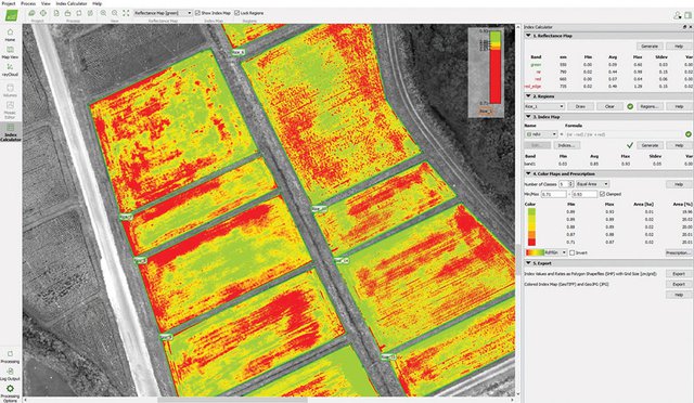
Mapping and profiling drone (NDVI Imaging
Here are just a few examples of proven payoffs that are tea-specific or tea-inevitable. The latter include the many pilots, programs in the design stage and scattered individual implementations:
Infra-red plant diagnostics: signs of plant stress are apparent through sensors ten days before the physical damage is visible. Drones carry multispectral cameras that can move just a few feet above plants
Mapping and profiling: Data is at the very core of precision agriculture and improve extend by an incalculable degree the costs, ease, and variety of capture and also usage. Each single plant has its own growth and health characteristics, each meter of land its own conditions, and each day its subtle and volatile weather shifts. There’s always been too much data for a farmer to process, though they develop their own skills of spotting and interpreting. They still have too little data to cover all contingencies and act quickly.
Drones change all this, supported by geospatial data analytic software and ability to communicate with experts remotely. They also augment or reduce the need for workers in the field, responsible for walkabout scouting, inspection, and surveillance. Drones have been neatly described as “high flying babysitters” for the fields.
Imaging and mapping: drones halve the costs of satellite imaging for farms smaller than twenty hectares and increase frequency of updates from around two days to whenever you want. They are unaffected by clouds.

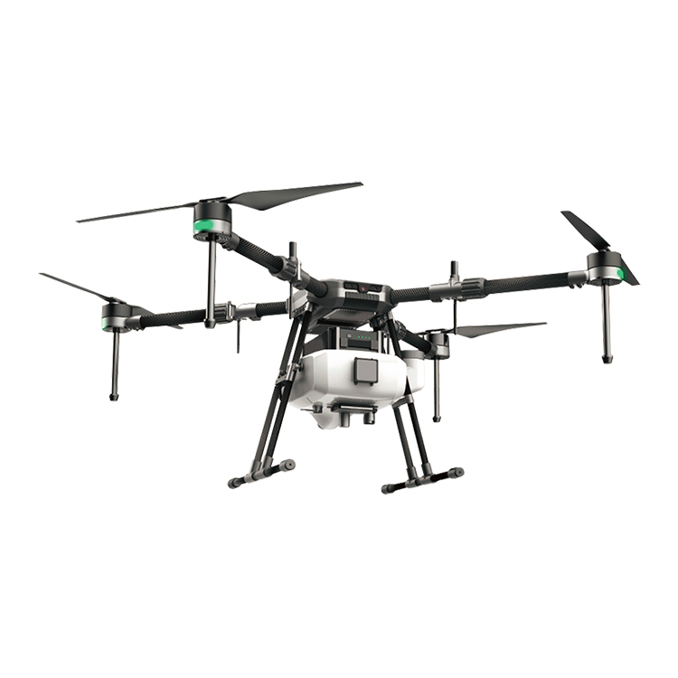
Spraying and fertilization: water savings in irrigation of up to 90%, chemicals reduced 30-50% and fertilizer use by up to 70%. Labor savings factor of 10 and up, 5 times faster than tractor application of pesticides. This is the “precision” in smart farming: delivering the exact amount at the exact location at the exact time instead of spreading it across an entire area. Over time, this should also greatly reduce the often appallingly high level of health hazards, many life-shortening, of workers that are the direct result of imprecise spraying.
Harvest yield: field mapping and farm profiling aid in such key areas as precision in fertilizer and water use. One of the most successful region-wide deployment of Big Data tools via drone data collection reports a doubling of yield and a 70% increase in smallholder incomes.
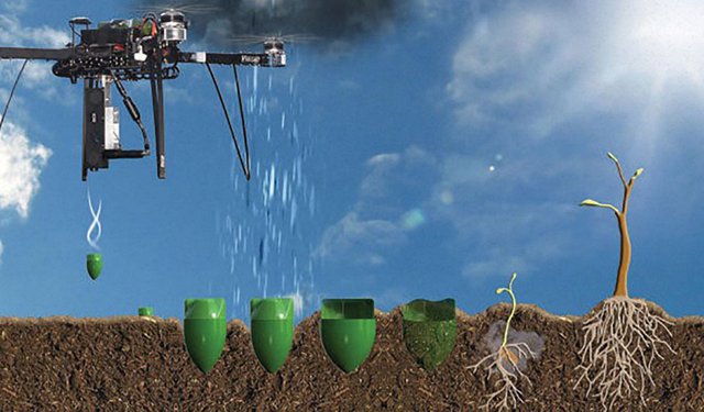
Planting: decrease in costs of 85%. The drones punch holes and shoot seeds and seedlings plus doses of nutrients in them for reforestation of trees that tea fields need in their environment to ensure biodiversity and shade. The latest drones can plant 40,000 trees a day.
The examples can be multiplied. It’s a little like listing smartphone apps. It will take many years for them to be fully deployed. Public sector development agencies, specialty service providers, farming experts, and government programs set the pace and provide much of the funding. There are many complexities involved in organizing, categorizing and standardizing data. Education and building trust among the traditionalist and natural risk-averse smallholder tea growing communities are a vital enabler. Expertise in tea farming has to be added to technology services. Internet connectivity is essential.
With all these caveats, the take-up rate of drones is accelerating in agriculture. It tends to be fastest in high-value crops; drones are near commonplace in Chinese fruit orchards where there is strong Provincial government support. Brazil is a major innovator in both drone manufacturing, software and use. Assam is a hive of planning, but key issues of funding are not resolved. Africa’s tea growing nations, especially Uganda and Malawi, are very active.

Contact: Fly Dragon Drone Tech.
Email: frank at dronefromchina.com
Add: NO. 9 Dayu Road PiDu distric, ChengDu 611730, China